
As the second edition of Belt and Road Initiative (BRI) Summit is underway in Beijing this Thursday, China on Saturday removed map from website of Belt and Road Initiative (BRI) Forum that depicted entire Jammu and Kashmir and Arunachal Pradesh as part of India.
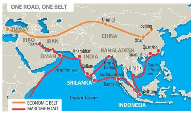
ET had reported on Friday that China displayed a map with BRI routes that curiously showed entire Jammu & Kashmir and Arunachal Pradesh as part of India. The map also surprisingly portrayed India as part of BRI even when India boycotted the summit for the second time. The map was displayed by China’s ministry of commerce on the occasion of the three-day BRI Summit. At the Summit the Chinese President made attempts to address concerns expressed by India over BRI.
It was totally self-contradictory that China has included entire J&K and Arunachal Pradesh as part of India as China recently destroyed thousands of maps which showed Arunachal as part of India. China has always described Arunachal Pradesh as “Southern Tibet” in Chinese government parlance and had protested the visits by top Indian leadership there.
Previous maps of J&K issued by China showed part of the state under Pakistan, called Pak Occupied Kashmir. Sources here indicated that such impair is a rare occurrence in China’s official publications and websites. Experts on Sino-Indian affairs are trying to ascertain if it is a deliberate tactical move by China to pacify India.
Last November, China’s state-run media (CGTN television) excluded Pak occupied Kashmir (PoK) from the map of Pakistan. A map of Pakistan excluding PoK was displayed by China’s state-run television while reporting terror attack on Chinese consulate in Karachi.
China has invested heavily in infrastructure projects in PoK even before BRI was launched, much to India’s discomfiture. India had served several protest letters both in Beijing as well as Islamabad, about Chinese funded projects in PoK. China had reportedly posted troops in PoK, a move that was sharply criticised by India.
Excluding PoK from the Pakistan map can also have implications for China-Pakistan-Economic-Corridor (CPEC). India has strong reservations on CPEC as it is passing through PoK that violates India’s sovereignty. CPEC is the most important connectivity link under China’s Belt and Road Initiative (BRI).


